VK2/HU-020, Unnamed Summit, Bindarra Forest Road, Carrabolla, 30/10/2018 - VK2NU/P.

Not wanting to travel too far, and looking for something with more than a single point, I scoured SOTAMaps for something in the Hunter Area. VK2/HU-020 had only had one previous activation (well two if include a New Year Rollover).
The previous week my beloved Elecraft KX3 had suffered some 'flood damage', and I wanted to give it a run, after drying it out, and getting it to power up again.
WX forecast was good, so left home at 6am,
M1-Motorway > Maitland > Tocal Rd > Gresford Rd > Allyn River Rd > Massey Creek Rd > James Rd > Boonabilla Rd > James Road (Again), and then finally parking at the intersection of James Rd and Boonabilla Rd (about 2hr 20min drive in total)
The last 11km or so, was on dirt road, but this was well maintained and 2wd friendly. This section of the drive passes by several farms, and I encountered cows and horses on the road. There are several small bridges and cattle grates along the way, but it's a public road, so no worries about trespassing!


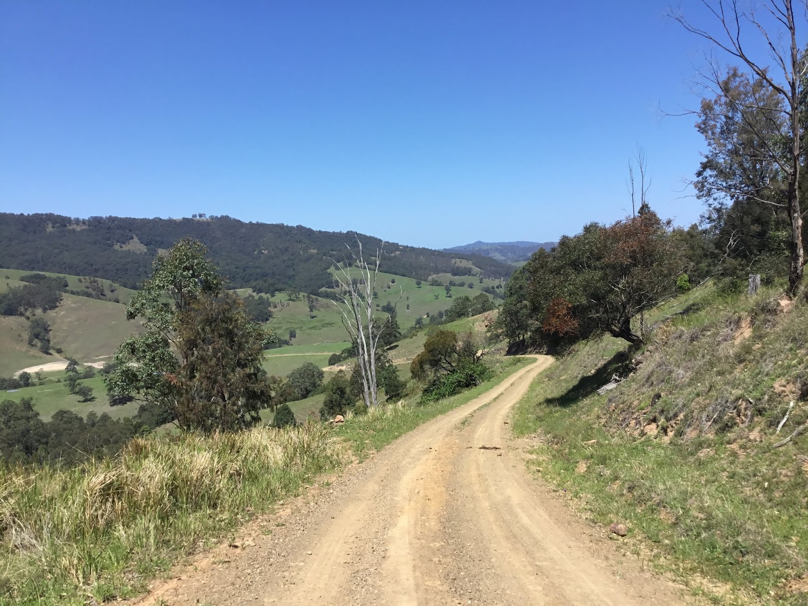


The picture above was where I left the car, with 4.7km to walk, according to Google Maps. This point can be viewed on street view in Google Maps, but the Google car didn't make it past here!
I did originally try to drive down James Rd, but only made it about 150m down the track, due to some deep ruts, before reversing back out. Most of the walk ahead would have been fine by car, but there were a few small sections that were rutted, although a half decent 4wd, would have handled these without issue. If you do decide to drive this, turning points and passing places are very limited. There was evidence of recent vehicle activity, so I assume the track is quite well used?
The map at the top of the page, shows several side roads and intersections along the trail, but in-fact, it was a simple case of following the road for 4.7km, and most of the marked side trails were no existent, or had been reclaimed by the bush.
Unfortunately the trail itself was tree lined for the entire route, with only a few very filtered glimpses of the surrounding countryside.


The trail was basically up, down and up, and was only moderately hilly. It was wet in parts, and rocky in others, but would be described as being in good condition and an easy walk!


The trail passes within about 130m of summit, according my GPS. Close scrutiny of SOTAMaps, and the more detailed SIX Map (9133-1S Carrabolla), Suggests that the high point of the trail is just outside the AZ (around 30-35m below the summit).
I spent over 30 minutes trying to find a route from the trail to the summit, but could get no closer than about 60m away according to the Garmin!

The point at which I, finally, left the trail was marked by a large fallen tree, that had been chainsawed, to prevent blocking the road.
I scrambled through the bush, gaining what I would estimate to be about 15m.
I was on air at 23:50UTC (a bit later than expected), and could only make 1 contact before the UTC rollover - thanks Peter VK3PF 40m-CW.
I did manage to activate the summit after the rollover with a further 6 contacts (VK3/4 on 40m and ZL1/2 on 20m). However, even though signals were good, it was tough going, and took 45 minutes. Local propagation (VK2), was no existent unfortunately.
I didn't time myself on the way in, but the walk back to the car took 1hr 20m, and was uneventful (but warm).

I had planned on driving out via a different route (due south on Boonabilla Rd, but encountered the following sign, so simply backtracked the way I drove in!

Signage in the forest was no existent, but I did find some remnants...


Summary
Phone coverage...Telstra: OK at the summit, but marginal on the trail.
Optus: No coverage at the summit or trail.
- A good drive!
- 4-points!
- Good walking trail, but no views!
- No cleared summit/OP!
- WX hot and sunny (30ºC when I got back to car).
- KX3 seemed to hold up OK, after its drowning attempt!
No comments:
Post a Comment