VK2/MN-063 Little Nellie, and VK2/MN167 Flat Rock Lookout (Flat Nellie), VK2NU/P 27/11/2018


SOTAMaps
Firstly, VK2/MN-063 Little Nellie, is in the wrong place on SOTAMaps. The summit is to the East of Coopernook Forest Way, and correctly shown on the SIX Maps (9436-4S Lorne) map.
Secondly, VK2/MN-167 is listed as Flat Nellie on SOTAMaps, but SIX Maps has this point named Flat Rock Lookout, with Little Nellie about 800m away to the South East. SIX Maps appears to be correct, but in this instance the actual SOTA Summit is in the correct place, but should be named Flat Rock Lookout.
A big thanks to Gerard VK2IO, for noting this previously otherwise it would have been a confusing trip!
There are lots of side roads and trails, but the main track is well sign posted. I had planned to take some photos on the way back out, but ended up leaving via a different route (more on this later).
The drive on Coopernook Forest Way is approx 18km. There is small parking area to the East of the track at the base of the summit (Coordinates: -31.71044,152.50941). This is not marked on any maps, but easily seen! Thanks again to VK2IO, for noting this!!
 Track to parking area, about 100m long.
Note: The above photo and several others show a [Play] button. These were taken on my iPhone, and I had it set up in Live Photo mode. This takes a 2 second video, instead of a photo. Other photos were taken using a iPad, and should be OK! Unfortunately I haven't yet found a way to remove this!
From here the summit ridge can be accessed via a very, very steep overgrown track. Horizontally this is less than 200m, but the climb is as steep as I've made, without rock-climbing equipment. Be very careful!
A big thanks to Gerard VK2IO, for noting this previously otherwise it would have been a confusing trip!
VK2/MN-063 Little Nellie.
A 5am start, had me driving north on the M1 and then the Pacific Hwy, turn off at Coopernook and followed the SatNav to Coopernook Forest Road. This is a dirt road that takes you through the Coopernook State Forest and the into Coorabakh National Park. The dirt road was pretty good and I had no issues with my 2wd i30, but it is steep in places and in the wet, it might be different proposition.There are lots of side roads and trails, but the main track is well sign posted. I had planned to take some photos on the way back out, but ended up leaving via a different route (more on this later).
The drive on Coopernook Forest Way is approx 18km. There is small parking area to the East of the track at the base of the summit (Coordinates: -31.71044,152.50941). This is not marked on any maps, but easily seen! Thanks again to VK2IO, for noting this!!
Note: The above photo and several others show a [Play] button. These were taken on my iPhone, and I had it set up in Live Photo mode. This takes a 2 second video, instead of a photo. Other photos were taken using a iPad, and should be OK! Unfortunately I haven't yet found a way to remove this!
From here the summit ridge can be accessed via a very, very steep overgrown track. Horizontally this is less than 200m, but the climb is as steep as I've made, without rock-climbing equipment. Be very careful!


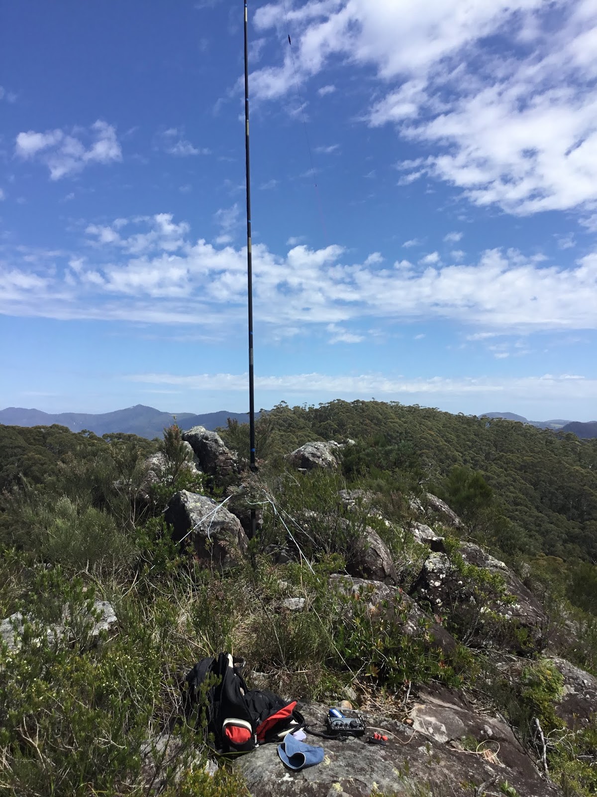


The climb took about 20 minutes, and is not for the faint of heart. The summit is on a ridge-line with steep drop offs either side, which the photos do not do justice. Fortunately the weather was good, with only a slight breeze, or it would have been dangerous on the top.
There are no trees to support antennas, so I tied the base of the squidpole to a short bush, and guyed the top of the first section to three other bushes (Again I was prepared for this thanks to Gerard). Due to limited space, I went with the 40/20/10 End Fed Antenna, in an inverted-L configuration.
Phone coverage was good, so self spotted making 10-contacts between 22:26 and 23:17 UTC on 40 and 20m, CW and SSB. Propagation seemed OK, but chasers were a little thin on the ground (and it was to get worse as the day went on)!
The climb down was more difficult than the going up, and most of it was done on my backside! The trail seems very lightly used, and it is not well defined, so care most be taken, but by good luck I found my way back without incident (although scratched and bruised). As usual I used my handheld GPS to waypoint the car-parking area, just in case!
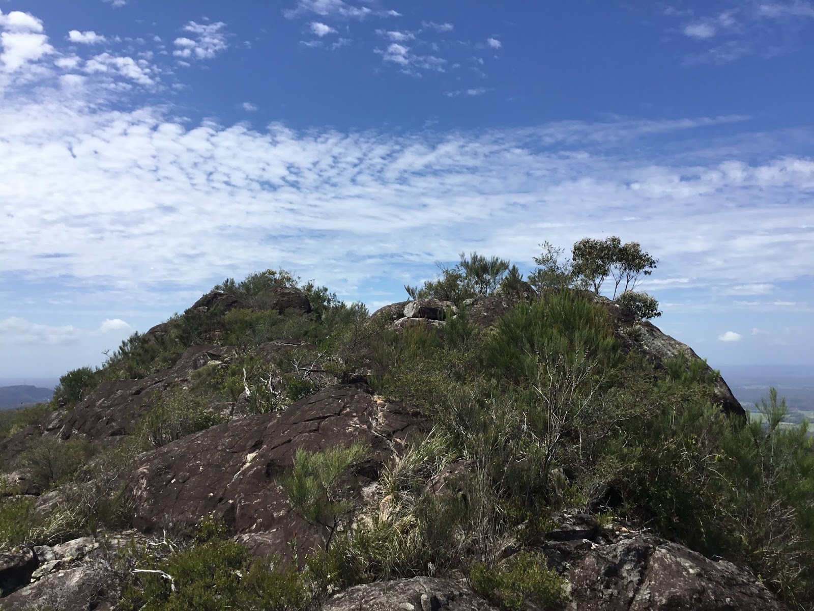
VK2/MN-167 Flat Rock Lookout.
Back in the car, headed North on Coopernook Forest Way, turn right onto Starrs Creek Road, and then left onto Big Nellie Road. 6.3km drive in total, brings you to Flat Rock Lookout.


The drive takes you through Starrs Creek picnic and camping area, which looks like a nice place for a stop (sorry no photos).


Again the photos do not do it justice, but there is a sheer drop off, of several hundred metres from the platform..
It took an hour to make 7 contacts (again 7/14, and cw/ssb). Signals were good, but it seemed that many of the usual chasers had better things to do!
Phone coverage was again good on Telstra and Optus.
As I was arriving a car was leaving the platform in the direction I had come, which made me think I could exit the area to the north, instead of going back the 25km along Coopernook Forest Trail? So I headed this way following the NP signs to the Pacific Hwy, via Hannam Vale, and Stewarts River. This again was straight forward, but mostly dirt track, and was no shorter than the trip in (just over 30km to the Highway).
Bonus 3rd Activation VK2/MN-066 Middle Brother
Being ahead of time and wanting the make the most of the day I headed to Middle Brother for a third summit. North on the Pacific Hwy, left onto Middle Brother Road, left onto TV Road, and left again onto Trig Road. About 7km all up from the Pacific Hwy, via an 'OK' Dirt Road.
After the previous two summits, this was very uninspiring, with two large radio masts in a compound at the top, and no views at all.


There is a Trig Marker below the main tower on the summit, but this cannot be accessed, as it is in the fenced area.
The site was quite busy when I arrived, with several vehicles in the compound, along with workmen. Not wanting to attract attention, I moved back down Trig Road a little, and set-up at the side of the road. Room was tight, and the mosquito's were biting, so I set up quickly, using the OCF dipole suspended from an overhanging tree branch, with the arms running parallel to the road. Beware, as there are overhead lines here!
I made 6 contacts between 04:08 and 04:30 UTC, on 40/20m, and made a hasty retreat after loosing the battle to the biting insects! This is not a summit I can see myself returning too!
The pictures above were taken on the way back to Pacific Hwy. I didn't bother taking any summit photos as I didn't want to draw the attention of the technicians at the summit towers.
Phone coverage was again good on both Networks. QRM was moderate to high on 40m, but OK on 20m!
Summary:
600km driving, about 80km on dirt roads! A 14 hour day, for 6 points. Views from the first two summits are about as good as it gets, and I'm surprised they haven't been activated more!
Caveat: On my way to first summit, I had initially set my SatNav to take me to Nellies Flat Road. This took me through Upper Lansdowne, on the Koppin Yarrit Road. This enters the National Park from the West, and should take you to Slaters Road and then onto Nellies Flat Road.
However, Koppin Yarrat Road was blocked/closed, and I had to turn around with still about 8km to go. This meant back tracking over 20km to come in from the South!
No comments:
Post a Comment