VK2/MN-200 Apple Tree, and VK2/MN-097 Purgatory Mountain - 25/09/2018 by VK2NU/P
Intro: Whilst scanning SOTAMaps for my next walk, I came across a hill I hadn't seen before that had never been activated and was close to the town of Bulahdelah. The summit was on a trail, in the Myall Lakes National Park, and looked pretty straight forward (if only returning 1-point). The plan was to tackle this one, VK2/MN-200 Apple Tree, then check out some other summits in the area. If these didn't work out, there were several other summits close by that I'd done before, and could fall back on.
VK2/MN-200 Apple Tree

2.2km with a climb of 310m
Left home just before 6am, M1 North to Bulahdelah and followed the SatNav for Cabbage Tree Road. This is a dirt Road but OK for 2wd cars. I'd taken this road before into the Ghin-Doo-Ee National Park, so was confident of this section.
Just after entering the Myall Lakes National Park, take a left turn onto Knob Road (Sounds like it should be from a 'Carry-On' movie). After about 450m, Apple Tree Trig Trail is on the left. This Trail was gated, rough and steep so parked the car here.

Gate at the start of Apple Tree Trig Trail
The trail is fine for walking, although it is steep, to very steep, in places and and was definitely a 'calf-burner'. The weather was overcast and cool but I had my jumper off in no time!
There are glimpses of the summit through the trees on the way up, but the walk is generally 'un-spectacular'.


One of the steep sections. The photo doesn't do it justice.
I thought I'd reached the summit, only to find another hill behind it, but finally arrived at about 9am, after a walk of about 1hr15m. Pretty slow for 2.2km.

Just about at the summit.
There is a short side trail leading to the summit, see above. Unlike the name suggests there was no Trig Marker to be seen, only a wooden post in the ground that had some barbed wire wrapped around it.
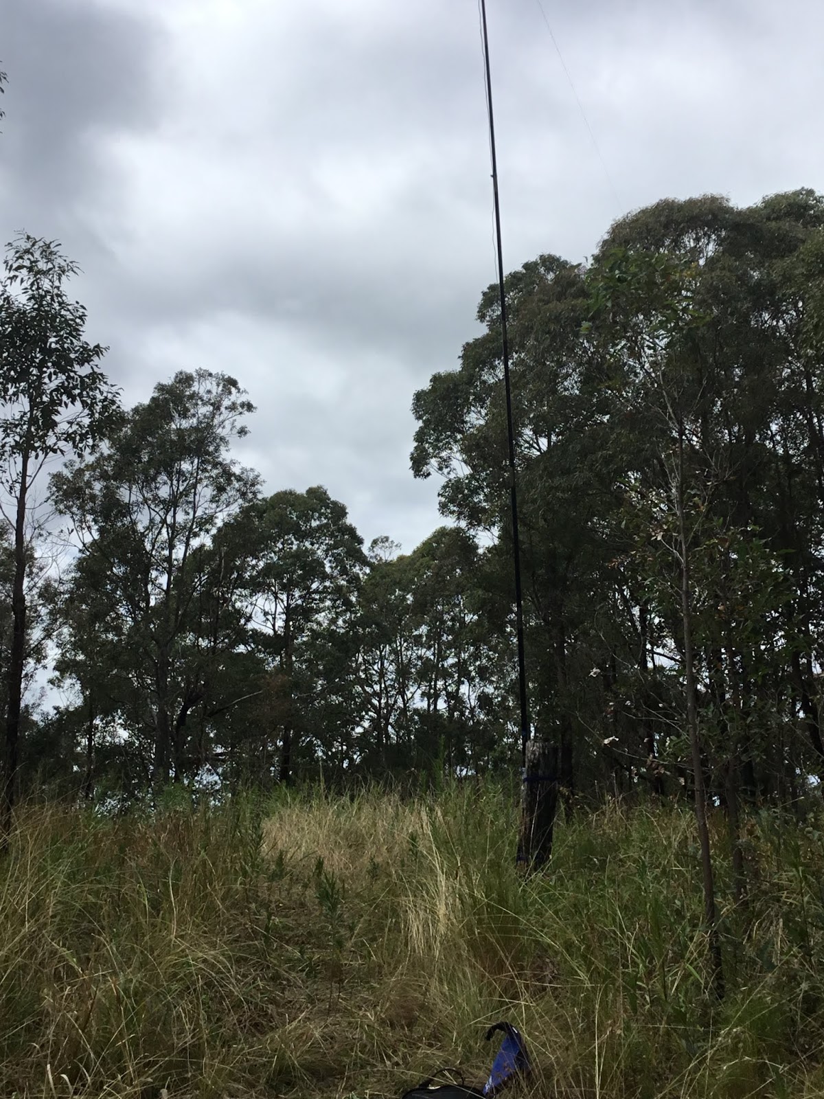


Proof of my efforts on the way up (sweat stained shirt drying on 'Trig' post).
There is plenty of open space on the summit, so set-up is easy but the views are very filtered through the trees.
I was set-up within a few minutes and first QSO was at 09:13 local with VK7CW (40m CW). Phone reception is good with both Telstra and Optus, so spotting was no issue.
9 QSO's (all 40m) were made before the rollover period, but only 1 after. Band conditions seemed poor, and I couldn't make any contacts on 80m (maybe due to my poor antenna), and only one contact was made on 20m, with ZL1BYZ after 00:00utc.
The trip down was uneventful, but the steep sections made walking tricky, although it took less than an hour to get back to the car.
Note: It may be possible to access the summit by 4wd from the other direction, as suggested in the signage, shown earlier?? (NEW: I tried to find 4wd access from the south in 2020, but could not find anything that didn't go through private land)
VK2/MN-097 Purgatory Mountain
With one new summit under the belt, I headed further into the National Park to check out another.

Trail Map
I drove 5.6km down Knob Road to the intersection with Crawford Road. This was a good dirt road, and well maintained. I was passed by a Forestry UTE, but didn't see any other people for the rest of the day.


Start of Crawford Road.
I parked the car at the intersection, due to Crawford Road being closed (see above). It turns out that a section of the road was washed out about 1km further on, but otherwise the road is good and easily drive-able.
A 1.7km walk brings you to a turn off for CPT 48/1 Trail.


Turn off towards summit
Crawford Road is pretty flat, easy walking and follows a stream for a most of this section.

Spotted this fella on route.
CPT 48/1 Trail started OK, with signs of recent 4wd access, but this soon turned bad with numerous fallen trees across the trail
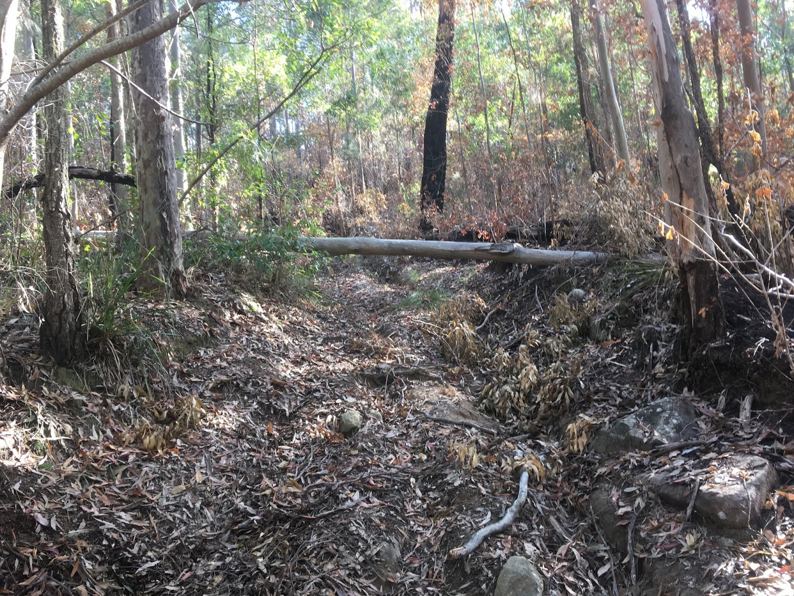


The first 500m or so of the trail, was relatively easy walking (apart from the blockages), but after this the trail became very steep, rocky and could be best described as a goat track.
I was too busy concentrating on my footing, to take any trail pictures at this stage, and as a result nearly trod on this fella!

After a short stand-off he moved on thankfully.
I followed CPT 48/1 Trail for 1.4km, with a climb of 210m. Most of the climb is in the last 500m or so, and my legs had gone to jelly by the time I reached the area where I had to leave the trail. This is at the highest point of the trail, and there is a clearing here that was good to take a short rest.

Clearing, where you have to depart the trail. Looking towards the summit.
As the earlier photos show the whole area had seen some recent bush fire activity. This was in my favour as it had cleared most of the scrub from last part of the climb.
The GPS was showing I had about 400m to get to the summit, with a climb of about 70m. This turned out to be easier said than done....


Further up, the soil has to turned to a field of rocks and boulders.
This final section was a field of rocks and boulders blackened by bush fire activity. Walking was hard with numerous trips and slippages.
Thankfully I didn't need to walk the full 400m as the summit levels out with a large saddle shaped AZ. I picked a spot on a burned tree stump to operate about 160m from where the GPS said the summit actually was.


Actual distance to summit coordinates, but well within the AZ.
Again views from the summit were very filtered, and this would have to be one of the least visually appealing summits I have visited, and it well suits its name of 'Purgatory'!
Set-up took some time due to rough terrain, and my tiredness, but I finally got on air by 1:47pm local time. Only made 7 contacts, including a difficult S2S with VK3XDM/P. At this stage, the temperature dropped and a light rain started, so I packed up ASAP, and made a slow careful decent, following GPS way-points I had set-up, on the way in.
Even though the bush was pretty clear due to the bush-fire damage, I would not have attempted the last section without the GPS (I've made this mistake before and hopefully never again).
I got back to the car a little before 4pm local time, and made it home by about 6.30pm, including a late lunch at Raymond Terrace.
Phone coverage from the summit was OK on both Telstra and Optus, but was non-existent for most of the climb up.
Summary: All up quite happy to get 2 new summits, but only 2 points for the effort required seems like a miserly return, but that's SOTA!
Good to read your story David after our difficult S2S on 80m. Certainly a good day of exercise for 2 points!
ReplyDelete73, Mitch VK3XDM/VK7XDM
As you say, David, some of the more difficult summits don't seem to return anything like the points you deserve for getting up them. But the easy ones even it out a bit. Well done staring down the snake. Unclear what alternative route there was for the first summit. I got the impression there was a barrier across it. thanks for posting and for the pics. always good to see the summits others visit.
ReplyDelete73 Andrew Vk1DA/2uh
Very exciting route,I brought my new sleeping bag to share with you.
ReplyDeletehttps://www.newbecca.com/product/523361831037