VK2NU/P Snowy Mountains - with VK2WFT/P - 12th to 15th March, 2018

12/03/2018, VK2/SM-093, Mount Livingstone
Jindabyne is over a six hour drive from home, so we looked for a nice and easy summit on the way down to activate. Livingstone Hill is just off the Monaro Hwy (B23), between Canberra and Cooma, and fitted the bill with it only being a 500m walk from the road.

Red circle marks a gate, and the parking area for the car.
The summit is accessed via Mount Livingstone Road. There is a gate leading to the summit, which is on private land. I parked the car at the gate, and as per instructions from previous operations, left a note on the dashboard with details of who I am, what I'm doing, and a mobile phone number. 'The owner is happy for people to access the site, but only under these conditions'.
The summit is only about 500m away from the gate, but up a moderately steep climb. There are 2 towers on the summit and a summit markers, which was used to attaching the squid pole.


Towers on summit
Phone reception was good (Telstra and Optus), so we were able to self spot. Luckily band conditions also seemed OK, and we were able to qualify the summit without issue.


VK2NU/P Hot and sunny on summit.
We spent about an hour on the summit, before heading off. A few cars passed us whilst we were loading up our gear, and waved, but we didn't speak with any locals.
All in all, and nice quick and easy summit for 6 points..
13/03/2018, VK2/SM-001 Mount Kosciuszko
No map needed for this one! A 35 minute drive from Jindabyne to Thredbo, stopping off to get a day pass for the Kosciuszko National Park ($17 per car per day).
The Kosciuszko Express Chair Lift runs from 09:00am to 04:15pm, costing $37 per person (for the day). The lift takes about 15 minutes, and brings you to the Eagles Nest. From here the walk is well sign-posted, and it is impossible to get lost (just follow the crowds).
All up, it's about 6.5km each way, with a few ups and downs.
It is possible to also access the Mountain via Charlotte's Pass, but this is longer.
Total walking time was about 2 hours.


Chair Lift, with Thredbo in the background.
I'd heard that the summit could get very busy, so made a call to take a vertical antenna, so that it wouldn't get in the way of other users. Unfortunatly, I was unable to tune this on 40m, and coupled with poor propagation, this made activating the summit difficult. Only 5 QSO's in about 1 hour.
The weather forecast, and the lady at the National Parks Kiosk, had said that the summit would only reach about 11ºC on the day of the activation. However, the day was warm, with temps around 23-25ºC. As such, we needlessly took some extra clothes, which were not used. "I suppose at this height, you have to be prepared for all eventualities'.
I had initially thought about activating Mount Townsend, VK2/SM-002 after Kosciuszko, but due to the timings of the chair lift, this would have been difficult to achieve.
14/03/2018, VK2/SM-014 The Cascades

Parked the car on the Alpine way, about 5km west of Thredbo.

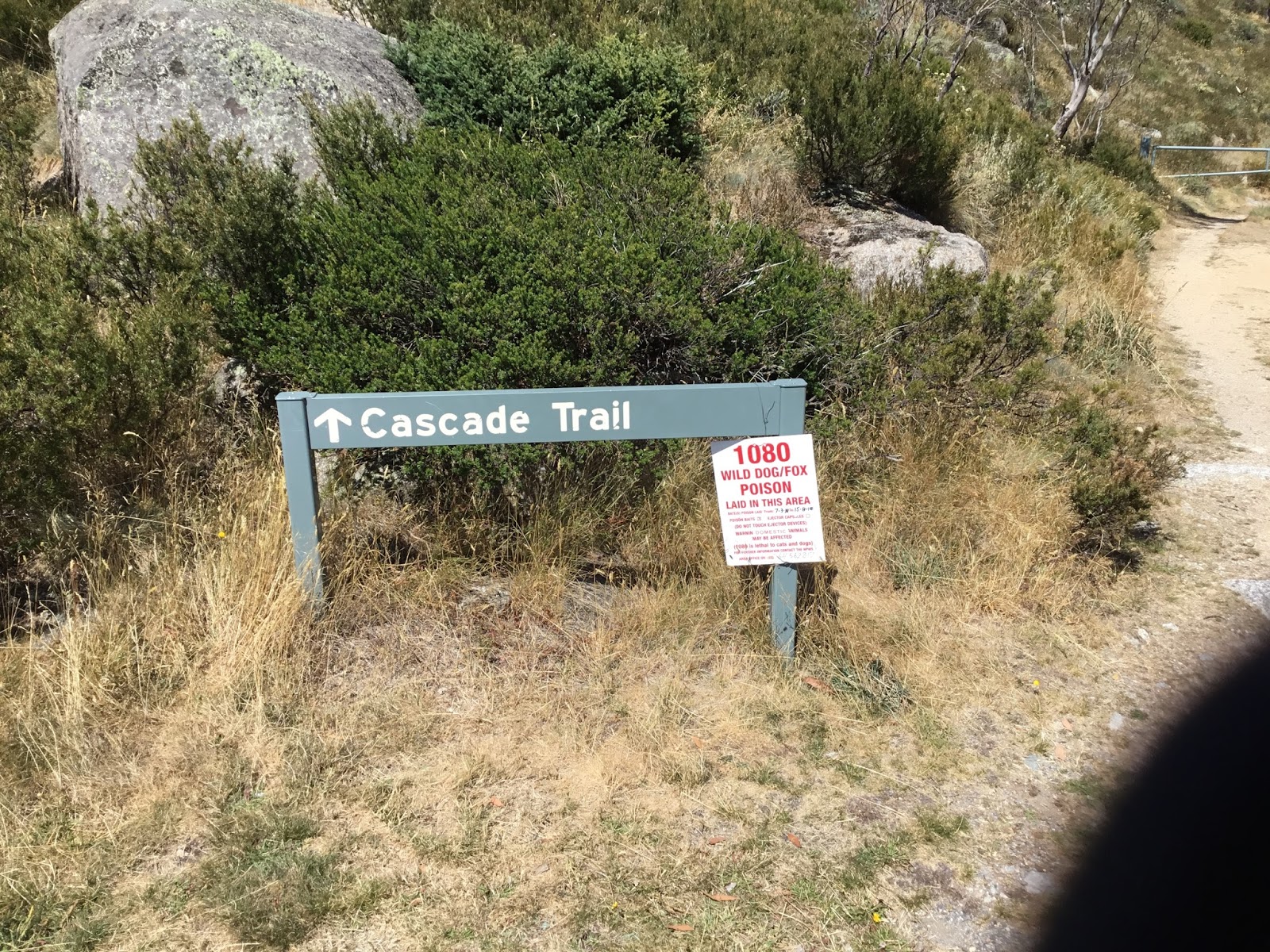
The first few Km of the trail follows the Thredbo River, and offers stunning views up the valley. After approximately 2km, the trail crosses a small bridge and then starts to climb.


About 1km after the bridge crossing, the trail heads into sparse woodland, which affords a bit of shade.

Several wild horses and deer were spotted on this section of the trail, but I wasn't quick enough to get the iPad out of the backpack, to take photos. This section of the trail is the steepest, and winds around the side of the summit.
We followed the trail until we were roughly due West of the summit and then 'went bush' for the last 400m or so.


The last, cross country, portion of the route, was not too difficult, but we used a GPS to ensure we didn't get lost. We also tagged the track with a waypoint on the GPS to ensure we would find it again on the way back down.


Another warm sunny day again, but poor propagation was again the order of the day, but we did manage to activate the summit, both sides of the 00:00utc rollover.
14/03/2018, VK2/SM-007 Mount Perisher

After returning from 'The Cascades', we drove to the Perisher Valley, about a 1 hour 20 minute drive, backtracking via Jindabyne.
We parked at the Alpine Eyre T-Bar Terminal on Kosciuszko Road. As per VK1DI and VK1NAM Blogs, linked from the SOTAWATCH Site, I followed the trail that starts about 100m to the left of the Eyre T-Bar. VK2WFT/P sat this one out!!


After the operation. There is a cafe off to the left, but this was closed when I got back down.
As the crow flies, the walk is only about 1.2km, but it is all uphill, and hard slog up a steep, very poor track. The track starts to the left of the T-Bar, but winds underneath it, about halfway up.
Time to the top, was just over an hour, but I needed a rest before being able to set-up.


Selfie looking back down...
There is a partial marker on the summit, but this required some rock climbing to access, and was far too windy for the squid-pole. I set up between the summit, and a building that had several antennas on it. This was sheltered and out of the sun..
Started operations at 15:30 local time, with first QSO being VK2WFT/P on 2m-FM, in the car below...
Conditions had improved since the morning activation, and I made 12 easy contacts on 7 and 14, CW and SSB, before packing up and heading down. It was noted in a previous Blog that there was no phone reception from here... This has obviously changed and Telstra and Optus were both good..


About halfway down, red car is just visible in the distance.
When I first viewed the summit from the road, I had second thoughts about climbing it, and it looked very daunting!! However, it wasn't as bad as it initially looked and the views from the summit were worth the effort.
Trip down was about 50 minutes, which included a wrong turn. Care is required in both directions as the track is poor, with several sections over loose boulders and rocks.
15/03/2018, VK2/SM-033 Blackfellows Hill

There are three summits in close proximity off Tantangara Road, which runs through the northern part of the Kosciuszko National Park.
The plan was to activate these in order of difficulty, leaving out the last one if time was running short (which is what happened).
A hour and a half drive from Jindabyne got us to Wares Yards Campground (Blue Circle on Map above). Tantangara Rd, and the road to the campground are dirt, but in good condition and fine for 2wd vehicles.
At the back right hand side of the campground, there is a low gate that leads to the summit trail. This initially heads south, but loops around onto a spur that heads north to the summit. The first 500m and last 500m are the steepest sections, but all in all the trail is quite easy. Time to the summit was about 1 hour and 20 minutes, only stopping to mark a few waypoints on the GPS.


Phone reception was poor here, with only marginal Telstra coverage (but just enough to spot, if I wandered around the summit).
I set up on the highest point of the summit, but my GPS was telling me that that actual summit was a further 50-60m away... Obviously SOTAMAPS is a little off!!
The summit is only partially wooded, so plenty of room for antennas etc, but still enough trees for a little shade. 7 contacts were made before the 00:00utc rollover, and another 7 afterwards. This included VK2WFT/P who had stayed with the car.
The summit trail is wooded all the way, so not much to see, but there are good views from the summit.. The trail branches in several spots, but these branches join again, and getting lost should be difficult.
Wares Yards Campground is a great spot to stay the night, and seems popular with horsey people!! When we arrived there were several campers already there, all with horse floats..
Got my first S2S of the trip, working ZL2ATH on ZL1/WL-138.
15/03/2018, VK2/SM-036 No-Name Summit..
An hours walk back to the campground, picking up the car and Tony. We drove a few kilometres south on Tantangara Rd to the trail head for VK2/SM-036. This is not marked, but is easy to see, and the coordinates are at -35.8882, 148.6229.
We left the car here and followed the track to the summit. The track crosses a firetrail, and under some power lines, before getting steeper.

No vehicle access. Sign after the fire-trail/power-lines.
The track gets much steeper after the fire-trail, and whilst the walk is only about 1.5km, it still gives the legs a good workout.


VK2WFT/P on SSB.
Propagation was OK from the summit, with some short range skip conditions resulting in a S2S contact with VK2GPL/P on VK2/CW-001.
Telstra phone coverage was OK, allowing self spotting without having to wander about!!
We packed up at about 15:30 local time, deciding to cancel the planned activation of Mt. Nungar VK2/SM-027. Lack of water, and time being the principle reasons.
Summary
- The good
- 6 summits, 56 Activator Points + 2 X S2S Contacts
- Great weather, but considerably hotter than expected or forecast.
- Only minimal March Fly bites, no leeches or snakes (only 1 sighted).
- The bad
- Always test and tune antennas before taking them into the field.
- Propagation - especially short skip (VK2/VK3)
Thanks to all the chasers.. This was my first trip to the area, and was well worth the effort..
Thanks for a detailed and entertaining multi summit report. I will be in a similar area over Easter on AC-001 and AC-003 camping overnight to get to both. VK1MIC.com.
ReplyDeleteCheers
Wade VK1MIC
Hi David hows the radio Going I hadnt heard back from you since you bought it off me looks like you had a good time in the local area
ReplyDeletecheers 73
Rod VK2TWR
Very informative report, thanks David.
ReplyDeleteRe the accuracy of sotamaps, you need to be aware that latitude and longitude of summits are rounded to 4 decimal places of a degree. Knowing that a degree of latitude is one nautical mile, you can figure out the possible error of 0.00005 degrees. The rounded data is stored and displayed by the SOTA.org.uk sites and sotamaps gets all its data from there. So the error starts in my computer and eventually finishes up as a mark on your GPS (it usually works ok!).
I hope to do a similar trip myself when I have time.
73 Andrew VK1DA/VK2UH
Great stories. Thanks
ReplyDeleteEnjoyed reading your reports David. Glad you found by blog entries useful. Have done all of these before. Yes Perisher does look daunting but turned out not too bad, short but steep...And can get quite windy on the top rocky bit. Not much luck hearing you in Canberra with poor NVIS on 40m.
ReplyDelete73 Ian VK1DI