New Zealand (North Island), Nov-Dec 2017, ZL/VK2NU/P.
Intro: Family Holidays for 2017 was a trip to the North Island (ZL1). This was very much a holiday, and SOTA was always going to be a secondary consideration, but I had hoped to squeeze in a few activation's.A round of cold/flu and the usual tourist activities got in the way of things, but I still managed 4 summits in the 2 week trip.
Coromandel Peninsula
ZL1/WK-195 Mount Paku (Tairua) - 27/Nov/2017 - 1 PointSummit in Headland, only a 10 minute walk from the parking area
I had my gear in the car, so I made a short side trip, whilst driving through Tairua. You can drive halfway up the summit, and a 15 minute walk, gets you to the top.
Approach to Summit.
The sun was in my eyes....
View to South, that's ZL1/WK-151 Pauanui at the end of the beach.
View towards the town of Tairua.
20m CW netted 5 east Coast VK stations, and and I hastily packed up, and got back to the family.
This is a very busy summit, and I had to do the usual explaining about what I was up to, at least half a dozen times. Then again, the whole activation took little more than a hour, and the views were stunning. Off to a good start (#1 on the first full day in NZ)...
ZL1/WK-113 Kaipawa Trig (Near Coromandel Town), 29/Nov/2017 - 2 Points
Not shown on the map, but the Trig Station was on a well sign-posted walking track.
This was my first planned summit, suggested by Warren ZL2AJ. The summit had not been activated before, which was a bonus, and Google showed it was on a Department of Conservation Track. Better still, I could do the summit in a morning, and still be back for afternoon tourist stuff..
Parking on State Hwy 25 (Whangapoua Road)... Track well signposted
Well formed track, starts gentle, but last 500m or so is steep. Track is mainly shaded, with only a few open sections.
Track markers...
Markers locating the Kiwi Boxes...
Halfway marker
Trig Sign... Station setup on the Kiwi Box/Trap..
Trig Marker (NZ Style)...
Being better prepared I had about 90 minutes at the summit, thankfully without anybody else about.
I started at 11:15am local time, and was able to work half a dozen North Island ZL stations on 40m-SSB before switching to 20m-CW, and working 6 east Coast VK's. Obviously the morning was better for local propagation, but still OK for Trans-Tasman QSO's on the higher bands.
WX was overcast, with light showers on the way in which stopped when I got to the summit. The Dept of Conservation were spot on, and the walk in took 1.5hrs, with the return journey being about 1 hour.
There are no views from the summit, but the steep climb leading to it, offers great views West to Coromandel Town.
West
North West
South... Showing State Hwy 25..
West Again...
I'm not quite sure if these boxes are used to catch Kiwi's for the captive breeding program, or to trap their predators? I passed about half a dozen on the trail, all marked with blue triangles on a nearby tree. The one at the summit was used as a makeshift table for the KX3..
Sign on Trail..
See above...
Sign at parking area??
Ready to head back to the Bach for a cold beer...
Lake Taupo
Tauhara, only 10 minutes drive from the town of Taupo.
We only booked 2 nights in Taupo, so I wasn't sure if I'd get time for a summit, but luckily, the resort we stayed at had a spa and waterpark, keeping the wife and kids happy for an afternoon.
Sign at the carpark area..
This was another one suggest by Warren, ZL2AJ, who's help was invaluable (along with others on the ZL-SOTA Facebook page).
Warren said this was an easy one, but it took me nearly 2 hours to make the summit, although I did get passed numerous times, by younger, and fitter trampers..
The first section is over a cow-field, marked with yellow poles, before entering the forest area.
Looking back down the trail. Car park is behind the bushy tree in the centre of the picture.. Note the yellow trail markers..
Looking up the trail, as you leave the farm via a stile... The summit is off in the distance behind the right-hand peak in the foreground.
Trail is narrow, and in thick bush. However, you cannot get lost...
At points, the trail is carved into the dirt, and you have to squeeze through gaps with walls over 4 foot high on either side..
Stream about two thirds up. A good spot for a rest and cool down.
On the summit. This is why they call NZ the land of the long white cloud...
Setting up shack... 2 metres away from a shear drop.
Pole strapped to an old Trig Post footing...
The summit was busy (mainly with German speaking tourists), so I planned to keep this short.. I didn't get on air until 4pm local time, and like Paku, I was unable to raise any NZ stations, even though several were alerted through the Facebook group. I only made 6 QSO's, all on 20m-CW, with East Coast VK stations.
Views from the summit were excellent in all directions, making the effort well worth it.
Lake Taupo, and the town of the same name..
There is a trail along the summit ridge, about a 100m long. The large rocks at the end provide a spectacular view over Taupo.
Trig Marker, looking back along the summit trail..
Very heavy interference was found on all bands above 40m, from what sounded like a FM Broadcast station ? This was unusual as there is no mast on the summit, but this has also been noted by other SOTA visitors.
The walk back down took half the time, although you need to fully concentrate on this one, due to the variability of the track.
So far so good, day 6, 3 summits off the list. Next stop Taranaki....
Taranaki
The main purpose of going to Taranaki, was to visit family I hadn't seen in about 15 years. I had hoped to do an easier summit whilst here, but family catch-up too priority, and I had to make do with a visit to a state forest at the base of Mount Taranaki.
Mount Taranaki... Maybe next time
Rotorua
We had six days in Rotorua, and I had hoped for 2-3 summits, but disaster struck. On the day we arrived, I came down with a Cold/Flu, making climbing the stairs of our townhouse a struggle (never-mind a summit), and on our first full day the wife injured her back on the Luge...
ZL1/WK-062 Ngongotaha, 09/Dec/2017 - 4 Points
Still suffering from a cold, this seemed like a nice easy one to tackle, which it proved to be. Again, thanks to Warren ZL2AJ for the info.
I only had the morning to play with as we were booked into Hobbiton in the afternoon, so I set off at 7.30am local time, getting to the car park area around 8am.
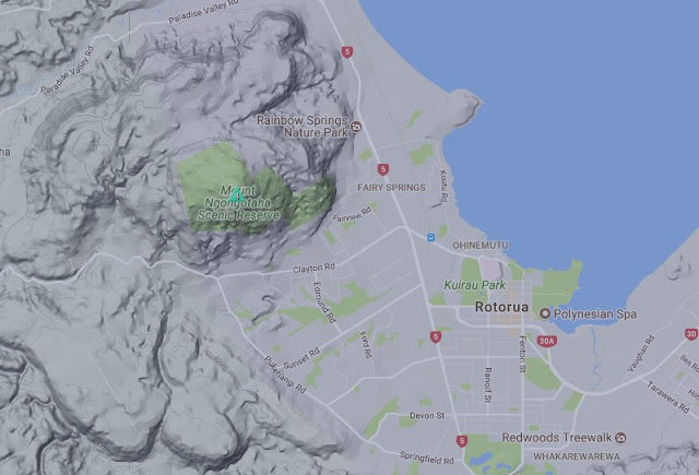
Map
There is a sealed road right to the summit (Mountain Road), but this is gated a few km from the end and must be walked.
Gate..
View back down the road.
Sealed road all the way, and a steady climb at best..
Alternate route in via Jubilee Track..
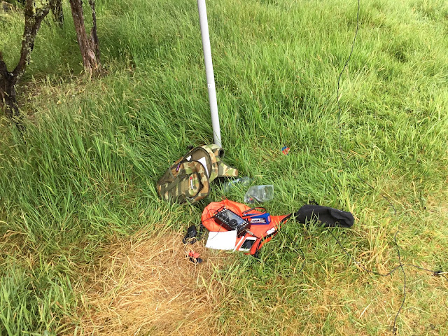
Shack at the base of the SOTA Beams Pole..
Roundabout on the summit
Mast stuck in a tree, OCF Dipole
Last selfie of the trip
A page of all ZL's, nearly..
First contact was on 40m-SSB at 9am local, and due to the early start, inter ZL was pretty good, with 11 worked. VK was a struggle on 20m, but a little better on 17m. As a bonus I worked three chasers in the US for my first long haul SOTA contacts... I spent nearly 2 hours on the summit, as it was cool and overcast, and not another hiker was seen.
I was back at the townhouse by mid-day, and we easily made our afternoon 'Lord of the Rings experience'.
With only 2 days left I had hoped for another summit, but unfortunately didn't make it....
I'd like to thank all the guys on the ZL-SOTA Facebook site, who actively chased me on the 4 summits, and especially Warren ZL2AJ, for all the detailed info on summits in my 'target' areas.
If you plan to visit NZ (and why wouldn't you), the local facebook group is a must, and the guys will make you feel more than welcome.


Fantastic
ReplyDelete